The Slow MachineTwo Facts That Cored the Apple
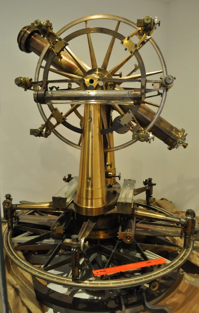

In 1802, the British began measuring India.
Not casually. Obsessively. The Great Trigonometrical Survey ran for most of the century, and it was one of the largest scientific undertakings of the human race — a chain of interlocking triangles marched across the entire subcontinent, over thousands of miles.
And to do it, they built giant, precision machines.
At the heart of it was the Great Theodolite — a monster of cast iron and polished brass, built in London by the instrument-maker William Cary and shipped out in 1802. It weighed eleven hundred pounds. Moving it took twelve men, hauling half a ton of delicate glass and brass gearing up swampy hills and onto rocky peaks, and it stayed in service for more than sixty years. Surveyors died of malaria, cholera and exhaustion in massive numbers. The operation cost more than most contemporary wars, and a great many lives.
The point was to know exactly where everything was. Because an empire that can't measure its territory can't tax it, police it, or lay railways across it.
And somewhere in the 1850s, in the course of doing this extremely practical, heavy-metal work, those thousand-pound instruments recorded an error they could not explain.
The error was small. About five seconds of arc — the width of a silver rupee seen from a mile away. Small enough to ignore. But carry it across six hundred kilometres of survey and the far end of your map is fifteen metres out of place. Enough to start a railway bridge on one bank and miss the other side.
And it meant the biggest mountains on Earth were not pulling their weight.
This is The Slow Machine. Episode three: two facts that cored the apple.
§ I
The Plumb Line Problem
Let me explain what went wrong, because it's beautiful.
To survey accurately with a theodolite, you need to know which way is true down. So you hang a lead weight on a line — a plumb bob — and it points toward the centre of the Earth. That's your absolute zero. Every angle, every boundary, every map coordinate depends on it.
Except a plumb line doesn't point only at the centre of the Earth. It points at the combined gravitational pull of everything around it. And if there happens to be a colossal pile of rock sitting to your north — say, the Himalayas — that mass will tug the plumb bob very slightly sideways, toward the mountains.
This wasn't a surprise. Surveyors knew it would happen, and they knew how to correct for it. You measure the mountain range's volume, multiply by the known density of granite, calculate the gravitational sideways pull, and mathematically adjust your plumb line.
The survey did exactly that at two stations in northern India — Kaliana and Kalyanpur. But when they applied the correction, the maths broke.
The plumb lines were being pulled toward the Himalayas — but by only about a third of what that massive pile of rock ought to exert.
Think about how strange that is. There is visibly, undeniably, an enormous mass of rock standing there. You can see it from a hundred miles away. And gravitationally, most of it isn't showing up.
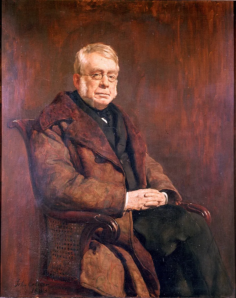

Two men attacked the problem. One belonged to the century that was ending, and the other to the one that was beginning.
John Henry Pratt was an archdeacon in Calcutta — a churchman of the East India Company who happened to be a formidable mathematician. George Airy was the Astronomer Royal: Greenwich, the national standards, the telegraph wires that pushed correct time out across the country, the specification for the great clock at Westminster, which he insisted must strike the hour accurate to within a single second. Theology on one side. Industrial modernity and the measurement of time on the other.
They built different models, and the difference between them still matters to geophysicists. But they arrived at the same conclusion — and it is one of the strangest conclusions anyone had yet reached about the ground.
George Airy, 18551I conceive that there can be no conceivable geological reason against this theory... that the state of the earth's crust lying upon the lava may be compared with perfect correctness to the state of a raft of timber floating upon water.
1 · VerbatimAiry, Philosophical Transactions, 1855
§ II
The Buoyancy of Mountains
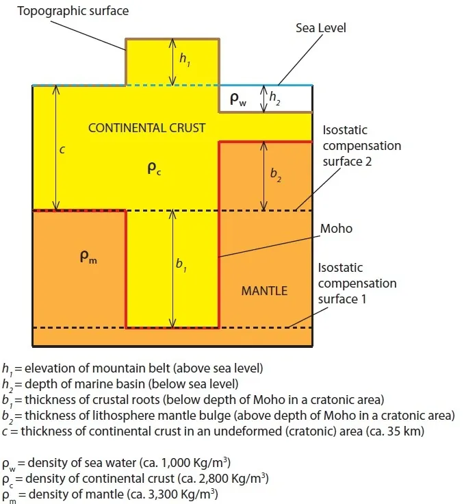

A raft of timber floating on water. Let's look at what Airy meant, because it changes how you see the planet.
Imagine a giant block of wood floating in a lake. If you want that block to stick out ten inches above the surface of the water, you need a massive section of that same block extending deep underwater to buoy it up.
A mountain is not a heavy brick resting on top of a solid stone floor. If it were, the weight would snap the crust. A mountain is an iceberg made of rock.
The Earth's outer crust is relatively light continental granite. Underneath it sits a denser layer of mantle rock. For a mountain range like the Himalayas to reach miles into the air, it must have a colossal, deep "root" of light crustal rock pushing miles down into that denser mantle below.
Now, recall the plumb line error.
Up in the sky, you have the visible mountain pulling the plumb bob toward it. But directly underneath the mountain, extending deep into the Earth, you have a massive root of light rock occupying space where dense mantle rock should normally be. The missing gravity from that light subterranean root cancels out most of the gravitational pull of the mountain above.
The mountains aren't hollow. They have deep roots. They are floating.
This principle is called isostasy — from the Greek for "equal standing." And its core lesson is simple:
The continents float.
Not as a metaphor. Physically. The light granite of the continents sits in dynamic, buoyant equilibrium on top of denser rock underneath.
If you pile weight onto a continent — say, a two-mile-thick ice sheet during an Ice Age — the crust sinks down into the mantle. When the ice melts, the continent slowly pops back up like a released cork. Scandinavia is still rising today from the weight of ice that melted ten thousand years ago, rebounding at nearly a centimetre a year.
§ III
The Trapdoors Slam Shut
Now let's go back to Eduard Suess and his shrivelling apple theory from last episode, and see how it holds up now that we know the continents float.
To explain why identical fossils appear on continents separated by vast oceans, Suess argued that ancient land bridges — continent-sized strips of dry land — had simply sunk to the bottom of the sea, becoming the ocean floor.
Isostasy completely destroys that idea.
Continental rock is light and buoyant. Mantle and oceanic rock are dense. You cannot sink a continent to the bottom of the ocean any more than you can push a block of wood to the bottom of a swimming pool and expect it to stay there. The moment you release it, buoyancy forces it back to the surface. There is simply no physical mechanism by which a land bridge can sink four kilometres into the Earth's interior and remain there.
This created the sharpest crisis in nineteenth-century science:
Fact One: Identical fossil species like Glossopteris and Mesosaurus exist in matching rock layers in Brazil, South Africa, India, and Antarctica.
Fact Two: Those creatures could not cross open oceans.
Fact Three: The kind of land bridge Suess needed — continental rock that sank four kilometres and stayed down — is physically impossible, because continents float.
Fact Four: And continents definitely, absolutely, cannot slide horizontally across the planet.
Those four statements cannot all be true.
Something had to break. By 1910, the first three facts were locked down by hard physics. Only Fact Four remained — and Fact Four was just an untested assumption everyone took for granted.
§ IV
The Fogged Plate and Nuclear Heat
While geologists were arguing over mountain roots, a French physicist was having a bad week with the weather in Paris.
In 1896, Henri Becquerel was trying to see if certain minerals emitted X-rays after being exposed to sunlight. He wrapped photographic plates in thick black paper, so no ordinary light could reach them, put uranium salts on top, and waited for a sunny day. If sunlight made the salts give off X-rays, the rays would pass through the paper and mark the plate.
Paris was overcast for days. Frustrated, Becquerel stashed the wrapped plates and the uranium together in a dark desk drawer.
When he finally developed the plates, expecting to see faint traces, they were pitch black — strongly fogged. The uranium was pouring out high-energy rays continuously, in total darkness, with no energy input from the sun at all.
This was the discovery of radioactivity.
And what happens next is this whole series in miniature. A fogged plate tells you that something is coming out of the uranium. It doesn't tell you how much. To get a number, Marie Curie reached for an instrument that had been built for something else entirely.
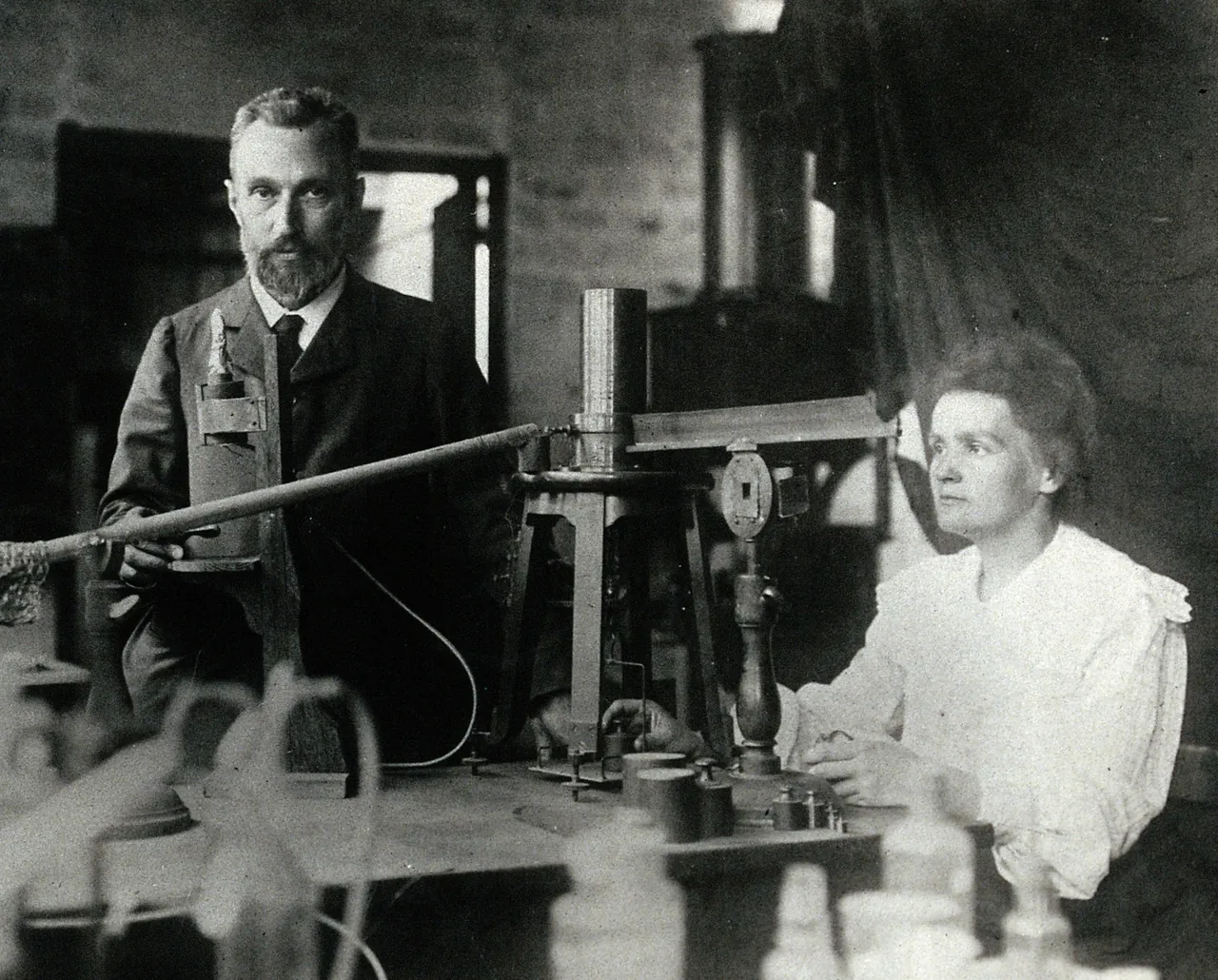

Years earlier, Pierre Curie and his brother Jacques had been studying what happens when you squeeze a crystal. Press on a piece of quartz, and a faint electric charge appears across its faces. The charges were minute — far too small for anything on the shelf — so the brothers built their own device to catch them. They called it a piezoelectric quartz electrometer. It was an instrument for crystal physics. Radiation had not been discovered yet.
Marie Curie took her husband's and her brother-in-law's crystal instrument and pointed it at uranium ore.
Now the rays had a number. And the number said something extraordinary. The activity depended only on how much uranium was present — not on what compound it was locked into, not on its temperature, not on whether you lit it or heated it or dissolved it. That ruled out chemistry entirely. Whatever this was, it was coming from inside the atom.
The electrometer also let her hunt. When an ore came out more active than its uranium content could possibly account for, she knew something else was hiding in it, and she chased that something by measurement until she had it in her hands. That is how radium was found.
And radium does something stranger still. It generates constant, measurable heat. A piece of radium produces enough heat every hour to melt its own weight in ice — endlessly, without burning anything, without any chemical change at all, and without becoming any less potent at the end of it.
Ernest Rutherford soon proved why: inside radioactive atoms, atomic nuclei are slowly disintegrating, shooting out tiny particles at immense speeds. As those energetic particles smash into surrounding rock, their kinetic energy converts directly into thermal heat.
Now think about what that does to Lord Kelvin's age of the Earth.
Kelvin had calculated that the Earth was only twenty to forty million years old. His entire mathematical model depended on one fundamental premise: that the Earth started as a molten ball and has been passively cooling down ever since, like a hot brick left on a porch, with no new heat entering the system.
But the Earth's crust is packed with uranium, thorium, and radioactive potassium. Every mountain, every ocean floor, every handful of dirt contains microscopic atomic furnaces pouring fresh heat into the rock, every second of every day, for billions of years.
The Earth wasn't just a cooling brick. It had an internal heating element.
And file one more thing away about the atom, because it comes back at the end of this story in a way nobody standing in a laboratory in 1903 could have seen coming.
The same physics that put fresh heat inside the Earth would, half a century later, be built into nuclear weapons. And when the two countries that had the most of them came round to the idea of stopping — at least out in the open air — they walked straight into the thing that blocks every agreement of that kind. You cannot promise to stop doing something unless the other side can tell whether you have.
So before there was a treaty, there was a network. More than a hundred listening posts, buried in sixty countries, every one of them built to the same specification, straining for the signature of a distant explosion.
It worked. It also, entirely incidentally, recorded the Earth's own tremors in more detail than seismology had ever managed — and that network, put in the ground so that a nuclear treaty could be signed at all, is what would eventually show us where the ocean floor goes when it dies.
We are a long way from that yet.
§ V
The Lecture
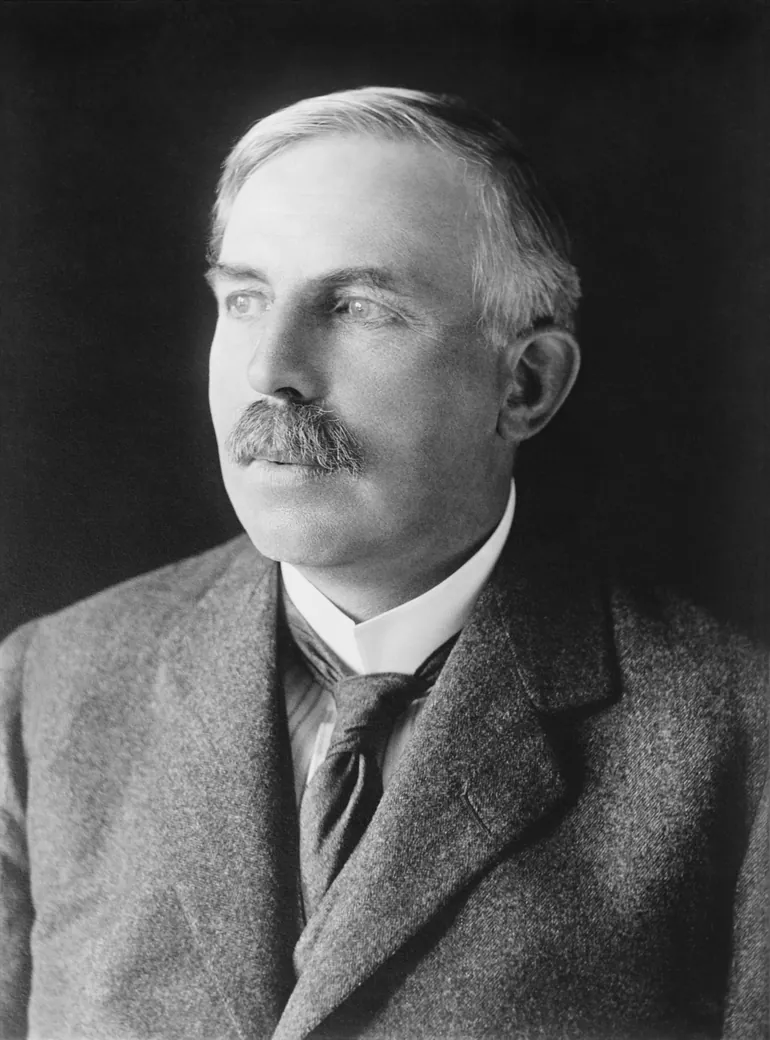

There is a famous story about how this realisation was delivered to Lord Kelvin himself — with the caveat that it comes to us from the man who told it about himself, decades later, so season to taste.
In 1904, Rutherford was set to give a lecture at the Royal Institution in London on radioactivity and the age of the Earth. As he walked up to the podium, he spotted Lord Kelvin in the audience. Kelvin was eighty years old, the grand old man of British physics, and the author of the very thermodynamic calculations Rutherford was about to blow apart.
Rutherford recalled feeling a wave of panic — until he noticed that Kelvin had drifted off to sleep.
Rutherford began his talk. But just as he reached his critical point about nuclear decay, the old man opened his eyes and fixed him with a sharp stare.
Rutherford pivoted on his feet. He told the audience that Lord Kelvin had famously calculated a young age for the Earth provided no new source of heat was discovered. And, Rutherford added smoothly, this prophetic caveat from his lordship referred directly to the discovery of radioactive heat today.
Ernest Rutherford, recalling, 1930s2Behold! the old boy beamed upon me.
2 · Verbatim fragmentRecounted in A.S. Eve's biography of Rutherford, 1939
Whether the old man beamed or not, the scientific reality was absolute. Kelvin's equations were mathematically flawless, but his starting premise was dead.
Radioactivity didn't just explain where the Earth's heat came from — it provided a precision clock. Because radioactive decay occurs at fixed, unalterable rates, measuring the ratio of uranium to lead in a mineral reveals exactly how old that rock is.
By the 1920s, a brilliant young British geologist named Arthur Holmes used radioactive dating to prove rocks were over a billion years old. Today we know the Earth is 4.5 billion years old. Kelvin had been wrong by a factor of more than a hundred.
§ VI
Wreckage
By 1910, nineteenth-century geology lay in ruins.
The cooling, shrinking apple model was dead. With nuclear decay heating the interior, the Earth wasn't rapidly chilling, which meant it wasn't shrinking, which meant thermal contraction couldn't be building mountains.
The sunken land bridges were dead. Isostasy proved continents float on denser rock and cannot sink.
The young-Earth clock was dead. The planet was billions of years old, leaving vast oceans of time for geological processes to work.
And yet, those identical fossil plants and animals were still sitting in matching rock strata across vast oceans, waiting for an explanation.
And here is the thing I find most human about this whole period.
Geology did not respond to this crisis by tearing down its old theories. It responded by ignoring the contradictions. Contraction theory remained in textbooks for decades because there was no alternative model to replace it. Science rarely discards an old idea just because it's broken — it discards it when a better one arrives.
And what arrived next was not immediately welcomed. What arrived was a thirty-one-year-old German meteorologist — a man with no credentials in geology whatsoever — who looked at a world globe and noticed what every schoolchild sees:
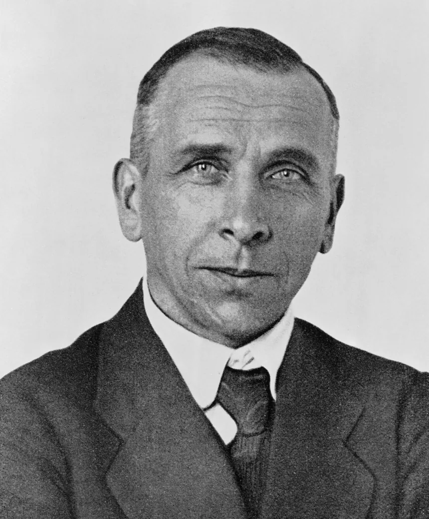

That the coastlines on opposite sides of the Atlantic Ocean look like matching pieces of a broken puzzle.
Everyone had noticed, but Alfred Wegener refused to treat that match as a coincidence. And that refusal would destroy his academic career, alienate his peers, and eventually cost him his life.
Next time on The Slow Machine: the weatherman. A torn newspaper, glacial scratches in the tropics, and the most comprehensively demolished good idea of the twentieth century.
Every episode of this series has a page at theslowmachine.com — the full transcript, and a table of every quotation in it with the source it came from. If you would like to write to me, the address is michael.goddard@theslowmachine.com.
Apparatus
Quotations, and where they come from
1Airy — "raft of timber"VerbatimAiry, Philosophical Transactions, 1855
2Rutherford — "the old boy beamed upon me"Verbatim fragment of a well-known anecdote, explicitly flagged on air as self-reported and lateRecounted in A.S. Eve's biography of Rutherford, 1939